Sinkhole Warnings Don't Faze West Texas
/https://static.texastribune.org/media/images/2016/07/11/sinkholes-007.JPG)
WINK — Sheriff George Keely’s truck bobbed as he cruised down a particularly warped and cracked stretch of county road.
“This is the road I don’t like to drive on if I don’t have to,” he said as brown-green West Texas scrubland reflected in the rearview mirror. The trip is riskier than he’d like.
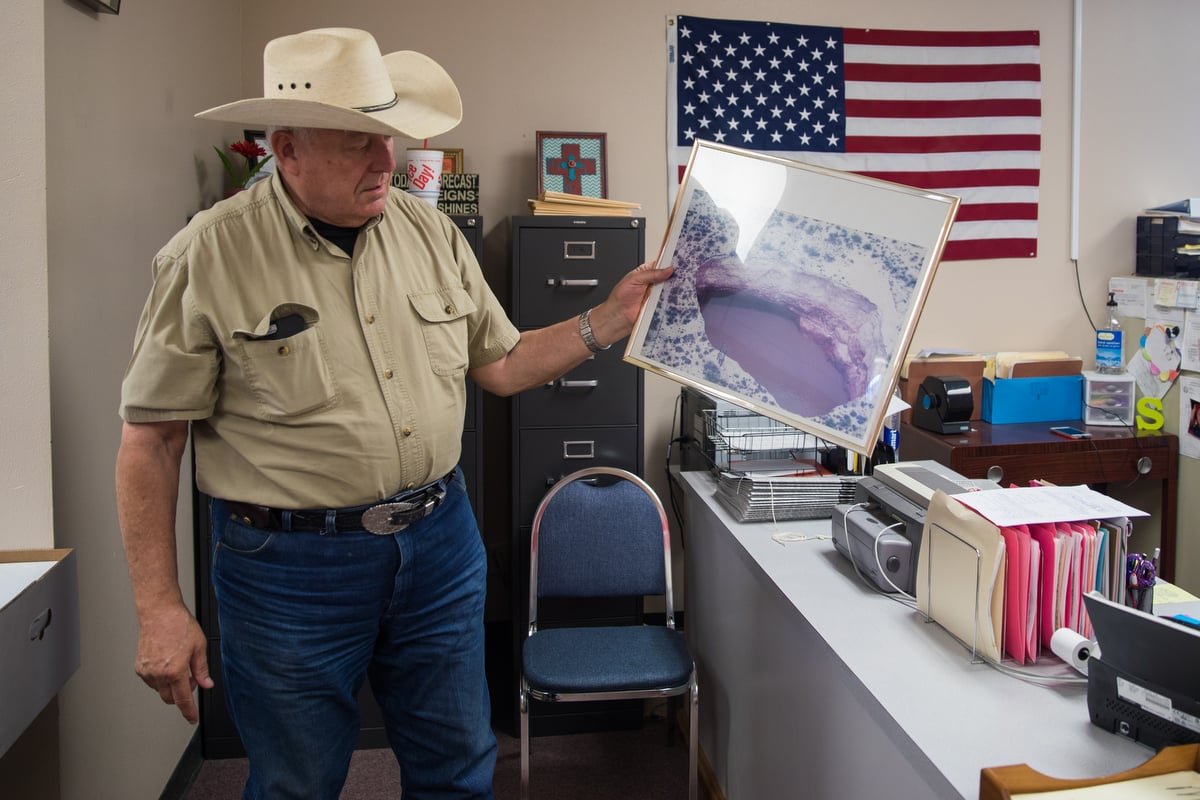
But here was Keely — a few months away from retirement after more than 20 years as a Winkler County lawman, five of them as sheriff — again escorting a reporter and photographer across the unstable terrain toward the Wink Sinks, the community’s chasms of fascination and fear.
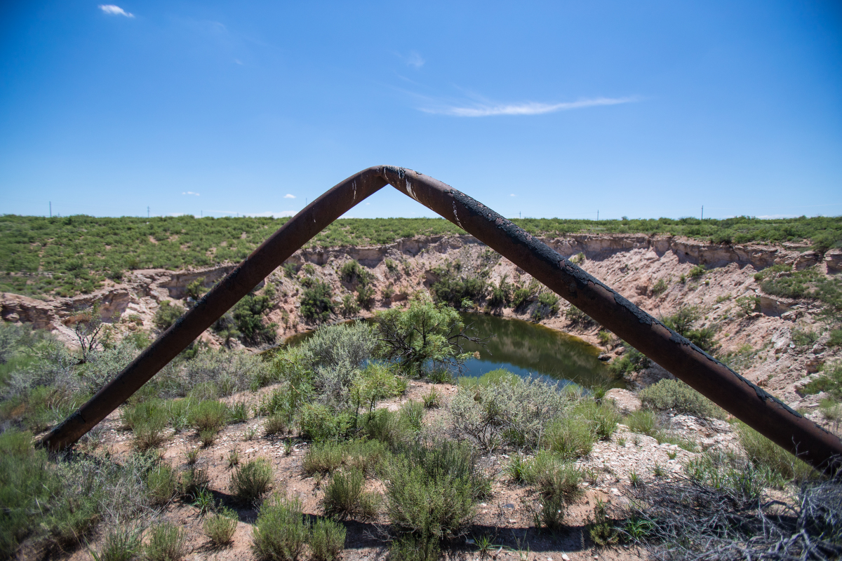
The two gaping sinkholes, which sit between the small towns of Wink and Kermit atop the largely tapped out Hendrick oilfield, aren’t new. Wink Sink No. 1 — more than a football field across and 100 feet deep when it collapsed — turned 36 years old last month. Its more massive cousin to the south, Wink Sink No.2, swallowed a water well, pipelines and surrounding desert back in 2002.
A recent study by two Southern Methodist University geophysicists has thrust the sinkholes back into conversations here and across the wider realm of social media.
The research, published last month in the peer-reviewed journal Remote Sensing, used satellite imagery to chart what other researchers and folks like Keely have noticed: the sinkholes keep growing, and land surrounding them is sinking — likely due to a mix of geology and human intervention.
The instability raises the possibility that more abysses could open without further notice, the SMU researchers suggested.
“A collapse could be catastrophic,” research scientist Jin-Woo Kim said in a statement upon the study’s release.
“I would be very concerned,” his partner Zhong Lu, a professor, said in an interview.
Those findings quickly garnered attention from news media across Texas and the U.S. and other websites. The headlines grew more alarming and less accurate as blogs and other websites aggregated and re-aggregated the news. (“Giant Sinkholes Threaten to Swallow Two Tiny West Texas Towns,” “Sinkholes May Take Texas Down”).
In Winkler County, the prognostications were greeted largely with a yawn.
“It’s kind of old news,” said Buford Cotton, finishing up lunch recently at Jerrie’s Café in Kermit with some buddies.
Cotton, a 61-year-old Kermit native who works for an oilfield service provider, said his sister in-law in Amarillo texted him “you need to move” after the SMU study came out. He doesn’t plan to do that.
None of the other three men at his table said they were particularly concerned.
And Keely’s not running for the hills either.
To be sure, the sheriff shares some concerns about the shaky ground — hence his reservations about driving across it. He worries nearby roads will grow more dangerous as 80,000-pound oil tankers continue to rumble down them. He worries that folks who sneak past the barbed wire and fences that surround the sinkholes — whether for a swim in their waters or just a peek at the oddity — will get hurt. That’s why he and his deputies occasionally monitor the area and tell gawkers to move along or face arrest for trespassing.
But those fears are relative in this county of crunched budgets, rattlesnakes and too many road deaths in other, less remarkable circumstances.
“We don't lose sleep over it,” Keely said. “The catastrophic event I’m most concerned about is if Hillary Clinton becomes president.”
So far, neither of the holes has threatened homes or businesses — just some oil and gas equipment and those curious stretches of road. Sink No. 2 is closest to either town, sitting about a mile northeast of the edge of Wink, population roughly 1,000 and the boyhood home of Roy Orbison, the soulful rock-and-roller.
If the hole dramatically expands, “Wink will have some beachfront property,” Keely jokes. “Somebody’s going to make a marina out of it.”
Sinkholes aren’t unusual in West Texas’ Permian Basin or other parts of Texas, but the Wink Sinks stand out for their breathtaking size.

They are the most fascinating features of Winkler County, but local officials cannot promote them to would-be visitors, what with the danger and fact that they are on land owned by two separate energy companies.
The first hole opened up about six miles south of Kermit in early June of 1980. It formed around an oil well first drilled in 1928 and abandoned in 1964, gulping tons of dirt and oil pipelines in the process.
The collapse sent oilmen racing to drain nearby storage tanks and reroute pipes, according to news reports at the time. And it raised stakes in a longstanding rivalry between Wink and its larger neighbor Kermit, as the towns feuded over what to name the phenomenon. “Wink Sink” ultimately won out over the less accurate “Kermit Krater” and the geographically neutral “Guacamole Hole-y,” a reference to the sinkhole’s avocado-green water.
“There’s no water and no excitement over here, so everybody chose that,” said Cotton, who years ago would get a look at the chasm while working on telephone lines for Southwestern Bell.
“I wasn’t always real comfortable going up next to it,” he said, recalling a thought that would swirl through his head: “I just hope it ain’t my day.”
If Kermit harvests any lingering resentment over the sinkhole’s name, it could not be found at Jerrie’s.
“Wink can have it,” said Dillard Barrick, who has lived there since the 1960s.
That hole now stretches more than 360 feet across, according to the SMU study, and the surrounding area is sinking up to 1.6 inches each year.
Research by the University of Texas’ Bureau of Economic Geology, which has been studying both sinkholes for years, suggests that freshwater seeped through natural and manmade fractures — perhaps including the old well itself or many others that pockmark the landscape — and eroded underground salts, accelerating the collapse.
The second sinkhole emerged 22 years later, encircling a well that was drilled in 1960 to supply water to the oilfields. Partly filled with blue water, it measures 900 feet across at its widest point. Land around it is sinking at a slower pace than its cousin, but the eastern side is collapsing at a clip of 1.2 inches per year.
Less has been confirmed about the precise mechanics of its collapse, but similar phenomena may be at play.
Meanwhile, researchers have pointed to other troubling spots in the area, including land more than half a mile from Wink Sink No. 2 that is sinking more than 5 inches each year.
Keely knows that area well: The intersection of County Roads 201 and 204.

“See ‘em? They’re all through this field,” said the sheriff, wearing a cattleman’s hat that revealed just a hint of short white hair. He pointed to fissures in the earth, some of them inches wide and who knows how deep. “It’s not just one. They’re all out there. See right here? See how the earth’s cracking? It’s unstable. The land is real unstable.”
The SMU scientists, who have not visited Winkler County and are mostly relying on the satellite data, wondered whether a third sinkhole could form here or in other “subsidence cones.”
Jeffrey Paine, a Bureau of Economic Geology research scientist who has extensively studied the holes, tempered his assessment of what might happen in those faster-sinking areas, which his team long ago identified. That’s partly because the sinking doesn’t appear to be speeding up.
“It’s kind of a continuous subsidence. It’s kind of a good thing. It probably keeps it from collapsing catastrophically,” he said. “Not to say that it couldn’t.”
Keely expects media coverage of the SMU study to prompt more people — locals and tourists alike — to try to sneak a glimpse at the Wink Sinks.
But Tammy Dominguez, a waitress in Kermit will not be among them.
“Hell no, I ain’t going out there,” she said. “The water’s so weirdly blue.”
Disclosure: The University of Texas at Austin and Southern Methodist University have been financial supporters of The Texas Tribune. A complete list of Tribune donors and sponsors can be viewed here.
Information about the authors
Learn about The Texas Tribune’s policies, including our partnership with The Trust Project to increase transparency in news.
/https://static.texastribune.org/media/profiles/Jim_1.jpg)